sábado, 16 de diciembre de 2017

Sayhuite Monolith: Can You Solve the Mystery of the 200 Designs Carved by a Forgotten Creator?


Long ago, forgotten artists put their blood, sweat, and possibly even tears into creating more than 200 designs on a monolith in what is now Peru. They carefully engraved the forms of reptiles, felines, shellfish, and frogs and then surrounded the sacred animals with terraces, ponds, river, tunnels, and irrigation canals. The exact purpose and meaning behind these features remains a mystery.
Sayhuite is a pre-Columbian archaeological site located in Abancay, a province in the southern-central Peruvian region of Apurímac. This site has been dated to the period of the Inca Empire, which flourished between the 15th and 16th centuries AD. Compared to other Incan sites, little has been left from the time of the Incas at Sayhuite. The most noteworthy object at Sayhuite is the Sayhuite Monolith, a mysterious boulder with lots of little carvings on it.
The Sayhuite monolith. ( Public Domain )
The name ‘Sayhuite’ is said to have its origins in the Quechua word ‘saywayta’, which translates as ‘place of orientation’. Located on the top of a terraced hill called Concacha, the site was once home to an enclosed sanctuary. All that remains of this sanctuary today is its raised platform, on which the Sayhuite Monolith may be found. According to some scholars, this site was one of the four sanctuary oracles of Apurimac, known also as the ‘sons’ of Pachacamac. There is, however, at present, a lack of archaeological evidence to establish the veracity of this claime.

Sayhuite Archaeological site (overview). (AgainErick/ CC BY SA 3.0 )
Unique Carvings
The Sayhuite Monolith is not the only carved stone in the area. In the valley below the site, there are a group of carved boulders known collectively as Rumihuasi (which means ‘stone house’). The carvings on the Rumihuasi monolith may be described as geometric, and consists of either steps and / or canals. The Sayhuite Monolith, on the other hand, contains not only carvings that are geometric in design, but also zoomorphic ones. Therefore, whilst it is not the only carved rock in the area, it is undeniably the most unique one.
The Sayhuite Monolith measures about 2 meters () in length, and 4 meters () in width. Although the stone may be found today on the raised platform on top of Concacha, scholars are not certain as to where it might have originally been placed. As the monolith is not a natural rock outcrop, it may have been transported there. The boulder seems to have been moved, perhaps by looters, sometime in the past. Apart from the question of its original location, scholars are also unsure as to who made this object.
In any event, the Sayhuite Monolith has attracted much attention thanks to its carvings. On the upper surface of the monolith, one may observe over 200 zoomorphic and geometric figures. The majority of the former are said to represent reptiles, felines, shellfish, and frogs. Some scholars have argued that the choice of these animals has a symbolic meaning that would have been comprehended by the Incas. For example, the felines may have been a reference to the Incan capital, Cuzco, and its elite, especially Pachacuti, the ninth Sapa Inca, and the first ruler of the Inca Empire.
Drawing showing the zoomorphic and geometric figures on the Sayhuite monolith. ( Maestroviejo)
Interpreting the Designs on the Monolith
Apart from zoomorphic figures, there are also geometric carvings on the monolith. These have been interpreted as representations of terraces, ponds, river, tunnels, and irrigation canals. If this were the case, then it may be said that the stone represented a scale model of the landscape. Some have even taken this interpretation further by suggesting that the Sayhuite Monolith was used as a topographic model for hydraulics. According to this theory, the monolith was used by the ancient Incan engineers as a model to experiment and observe the flow of water, which would then be implemented in public water projects. Moreover, such a model could have been used as a pedagogic tool for other engineers and technicians in this trade.

video del Monolich Sayhuite


Peru recovers 79 pre-Hispanic textiles from the Museum of Gothenburg in Sweden

Textiles belonging to the pre-Inca Paracas culture, dating to 700 BCE-100 BCE, are shown at Peru's Culture Ministry in Lima on December 14, 2017. Fifty lots of 79 textiles from the Paracas culture, recently repatriated, were delivered to the Culture Ministry as part of a second shipment, agreed in 2014 between the governments of Peru and Sweden. Ernesto BENAVIDES / AFP.


LIMA (AFP).- Peru has recovered 79 pre-Hispanic textiles that have been illegally located in Sweden since 1935, the ministry of culture said. 

In 1935, Swedish ambassador to Peru Sven Karrell acquired the fabrics hailing from the Nasca and Paracas cultures and took them to Sweden illegally -- anonymously donating them to The Museum of Gothenburg, according to the Peruvian government. 

"Thanks to the collaboration between the foreign minister, the culture minister and the city of Gothenburg, we are celebrating the arrival of the second of the three scheduled deliveries, made up of 79 textiles," said Jorge Arrunategui, deputy minister of cultural heritage and cultural industries. 

The delivery included wraps, cloths and decorative textile borders from the pre-Hispanic Paracas culture, an Andean society known for their unique composition, colors and weaving techniques using cotton and wool from vicunas -- the national animal of Peru, related to the llama. 

The textiles, repatriated on December 7, were made between 700 BC and 200 AD and are among items the Swedish government promised to return to Peru in a 2014 agreement. 

In 2008, the Gothenburg Museum of World Culture held the exhibition "Paracas: A Stolen World," prompting Peru to begin investigations and in 2013 begin the process of recovering the items. 

The recovered goods will be kept by the Ministry of Culture's General Directorate of Museums for conservation, and displayed in 2018. 

viernes, 15 de diciembre de 2017

The College Student Who Decoded the Data Hidden in Inca Knots

There are many ways a college student might spend spring break. Making an archaeological breakthrough is not usually one of them. In his first year at Harvard, Manny Medrano did just that.

“There’s something in me, I can’t explain where it came from, but I love the idea of digging around and trying to find secrets hidden from the past,” Medrano says.

With the help of his professor, Gary Urton, a scholar of Pre-Columbian studies, Medrano interpreted a set of six khipus, knotted cords used for record keeping in the Inca Empire. By matching the khipus to a colonial-era Spanish census document, Medrano and Urton uncovered the meaning of the cords in greater detail than ever before. Their findings could contribute to a better understanding of daily life in the Andean civilization.

Manny Medrano '19, right, explains the meaning of quipus knots while holding a model. Quipus are knots that Incas used to record censuses, etc., and there are only 1000 left in the world. Medrano is the first name on the paper he co-wrote with Professor Gary Urton, left, Dumbarton Oaks Professor of Pre-Columbian Studies, that is being published in EthnoJournal.

Jon Chase/Harvard Staff Photographer

The Inca Empire reached its height of power in 15th- and 16th-century Peru. When Spanish conquistadors invaded, the Inca had established the largest and most complex society in the Americas. Architectural marvels from the civilization, such as Machu Picchu, survive to this day, but the Inca left behind no written records.

“The only sources we have at present are chronicles of the Inca that were written by the Spaniards,” Urton says. “We know in a lot of cases those histories were skewed by Spanish beliefs and Spanish motivations, and so we don’t really have any indigenous Inca history.”

The only records the Inca are known to have kept are in the form of intricately knotted khipu textiles. In 2002, Urton began Harvard’s Khipu Database Project. He traveled to museums and private collections around the world to record the numbers of knots, lengths of cords, colors of fibers, and other distinguishing details about every Inca khipu he could find—more than 900 in total.

Urton says he and other researchers in the field have always had a general sense of what the khipus represented. Many, they could tell, had to do with census data. Others appeared to be registers of goods or calendar systems. But, until recently, none of the khipus Urton studied could be understood on a very detailed level. If the khipus held messages or cultural information beyond just numbers, the meanings were opaque to modern scholars.

A turning point came when Urton began looking into a set of six khipus from the 17th-century Santa River Valley region of Northwest Peru. One day, Urton picked up a book and happened to spot a Spanish census document from the same region and time period.

“A lot of the numbers that were recorded in that census record matched those six khipus exactly,” Urton says.

It was an exciting enough coincidence that Urton mentioned it to his undergraduate students at the end of class in the spring of 2016. For Medrano, who was sitting in the lecture hall that day, it was too enticing of a lead to ignore.

“I walked up to him and said, ‘hey, spring break is coming up, if you need someone to put a few hours into this, I’d be happy to take a look,’” Medrano recalls.

Medrano, now a 21-year-old junior, was a freshman at the time. He is majoring in economics, but had always found archaeology interesting and had enrolled in Urton’s course on the Inca civilization, curious to study a period of history about which he knew little.

Urton agreed to allow Medrano to look into the Santa Valley khipus and the Spanish census. “[I wasn’t] thinking he’d ever do much with it because I’d had one or two other people look at it before and nobody could ever come up with anything,” Urton says.

The khipus in question are in a private collection in Peru, so Medrano worked from information Urton had recorded in his khipu database. Medrano recalls combing through spreadsheets in Microsoft Excel, graphing some of the data, and enjoying the hunt for patterns.

“I have a love of puzzles, just for entertainment. I love to do a Sudoku on a plane or something, but this is so much more profound,” he says.

Medrano comes from a Mexican-American family and speaks Spanish, so understanding the Spanish census document was no problem. Handling numbers and data came naturally to him as well, as an economics major. The challenge, as both Medrano and Urton note, seemed to demand a perfect alignment of his skills and interests.

“Not every archaeology project operates in Excel,” Medrano points out.

Medrano noticed that the way each cord was tied onto the khipu seemed to correspond to the social status of the 132 people recorded in the census document. The colors of the strings also appeared to be related to the people’s first names. The correlations seemed too strong to be a coincidence. After spring break, Medrano told his professor about his theories.

“I just remember being pretty excited, that, ‘Wow! I think the guy’s got it,’” Urton says. “There were a couple of things that didn’t add up and I’d point that out and he’d take it back and work on it for a week or two and come back and he would have understood something about it at a deeper level.”

Medrano worked with Urton over the next several months and the two compiled their findings into a paper which will be published in the peer-reviewed journal Ethnohistory in January. Medrano is the first author on the paper, indicating he contributed the bulk of the research, something Urton notes is extremely rare for an undergraduate student.

Sabine Hyland researches Andean anthropology at the University of St. Andrews. She has read Medrano and Urton’s forthcoming paper and describes their discoveries as “thrilling.”

“Manny has proven that the way in which pendant cords are tied to the top cord indicates which social group an individual belonged to. This is the first time anyone has shown that and it’s a big deal,” Hyland says.

Urton is now optimistic that the six khipus examined in the research could serve as a key to decode the hundreds of others he has in his database. The colors of the cords as they relate to first names could hint at the meanings of colors in other khipus, for example.

“There’s a lot we can draw on from this one case,” Urton says.

But what’s most exciting to Urton and Medrano is the potential to better understand Inca history from the indigenous point of view. As Medrano puts it, “history has been written from the perspective of the conquerors and to reverse that hierarchy is what I see this project as doing.”

miércoles, 13 de diciembre de 2017

Cara de la antigua reina Wari (Huarmey)

Cara de la antigua reina revelada por primera vez Siglos después de que una noble viviera y muriera en Perú, los científicos han reconstruido su rostro en impresionantes 3-D.   EXCLUSIVO: CARA DE LA REINA ANTIGUA REVELADA POR PRIMERA VEZ Hace unos 1.200 años, una adinerada noble, de al menos 60 años, fue sepultada en el Perú, rica en provisiones para toda la eternidad con joyas, frascos y herramientas de tejido de oro. Ahora, más de cinco años después de que su tumba se encontró intacta en las afueras de la ciudad costera de Huarmey, los científicos han reconstruido su aspecto. "Cuando vi por primera vez la reconstrucción, vi a algunos de mis amigos indígenas de Huarmey en esta cara", dice el becario de National Geographic, Miłosz Giersz, el arqueólogo que co-descubrió la tumba de la nobleza. "Sus genes aún están en el lugar". En 2012, Giersz y el arqueólogo peruano Roberto Pimentel Nita descubrieron la tumba El Castillo de Huarmey. El sitio de la ladera fue una vez un gran complejo de templos para la cultura Wari, que dominó la región siglos antes que el famoso Inca. La tumba, que los saqueadores perdieron milagrosamente, contiene los restos de 58 mujeres de la nobleza, incluidas cuatro reinas o princesas. "Este es uno de los descubrimientos más importantes de los últimos años", dijo Cecilia Pardo Grau, curadora de arte precolombino en el Museo de Arte de Lima, en una entrevista anterior. (Lea más sobre el increíble hallazgo en la revista National Geographic). Una de estas mujeres, apodada la Reina Huarmey, fue enterrada con un esplendor particular. Su cuerpo fue encontrado en su propia cámara privada, y estaba rodeado de joyas y otros lujos, incluyendo bengalas de oro, un hacha ceremonial de cobre y una copa de plata. ¿Quién era esta mujer? El equipo de Giresz examinó cuidadosamente el esqueleto y descubrió que, al igual que muchas de las nobles del sitio, la Reina Huarmey pasaba la mayor parte del tiempo sentada, aunque usaba mucho su parte superior del cuerpo: las tarjetas de visita esqueléticas de una vida dedicada al tejido. Su experiencia probablemente explica su estado de élite. Entre los wari y otras culturas andinas de la época, los textiles se consideraban más valiosos que el oro o la plata, lo que refleja el inmenso tiempo que tardaron en hacer. Giersz dice que los textiles antiguos encontrados en otras partes de Perú pueden haber tardado de dos a tres generaciones en tejer. La Reina Huarmey, en particular, debe haber sido venerada por su tejido; ella fue sepultada con herramientas tejidas a partir de oro precioso. Además, le faltaban algunos de sus dientes, lo que es consistente con la decadencia que viene con beber chicha regularmente, una bebida alcohólica azucarada a base de maíz que solo la élite Wari podía tomar. El equipo de Giersz también ha encontrado un canal que conduce desde la tumba de la Reina Huarmey hasta las cámaras exteriores que contienen residuos de chicha. El canal habría permitido a las personas compartir ceremonialmente líquidos con la mujer noble, incluso después de que su tumba estuviera sellada. "Incluso después de su muerte, la población local seguía bebiendo con ella", dice Giersz. ¿Pero cómo era esta poderosa mujer noble? En la primavera de 2017, Giersz consultó con el arqueólogo Oscar Nilsson, reconocido por sus reconstrucciones faciales, para devolverle la vida a la Reina Huarmey. TAMBIÉN PODRÍA GUSTARTE Vea algunas de las obras de arte de rock más grandes del mundo, escaneadas por primera vez Este perro mexicano sin pelo tiene un pasado legendario y antiguo El fuego quema el antiguo templo peruano Nilsson no es el primero en tratar de reconstruir las caras de la élite precolombina de América del Sur. Recientemente, los arqueólogos resucitaron a la Señora de Cao, una joven aristócrata que vivió hace 1.600 años en la antigua cultura Moche del Perú. (Vea cómo las herramientas de CSI le devolvieron la vida a la Señora de Cao). A diferencia de esa reconstrucción, que se hizo casi en su totalidad con computadoras, Nilsson adoptó un enfoque más manual para la Reina Huarmey. Utilizando un modelo impreso tridimensional del cráneo de la nobleza como base, Nilsson reconstruyó sus rasgos faciales a mano. Para guiarlo, Nilsson confió en la construcción del cráneo, así como en los conjuntos de datos que le permiten estimar el grosor del músculo y la carne sobre el hueso. Como referencia, también usó fotografías de indígenas andinos que vivían cerca de El Castillo de Huarmey. (Los datos químicos confirman que Huarmey Queen creció bebiendo el agua local, justificando la comparación). En total, Nilsson tardó 220 horas en reconstruir el rostro pensativo de la noble, sin ningún detalle demasiado pequeño como para ignorarlo. Para reconstruir su corte de pelo, que el clima árido había conservado, Nilsson usó pelo real de ancianas andinas, que Gilesz había comprado en un mercado peruano de suministros de pelucas. "Si consideras que el primer paso es ser más científico, poco a poco entraré en un proceso más artístico, donde necesito agregar algo de una expresión humana o una chispa de vida", dice Nilsson. "De lo contrario, se parecería mucho a un maniquí". Algunos tendrán la oportunidad de ver la obra maestra de Nilsson en persona. La reconstrucción final estará en exhibición pública a partir del 14 de diciembre, en una nueva exhibición de artefactos peruanos que se inaugurará en el Museo Nacional Etnográfico de Varsovia, Polonia.

viernes, 1 de diciembre de 2017

Nazca lines


The overwhelming majority of people who travel to the town of Nazca, Peru come to see the famous Nazca Lines. We did too, exploring the Nazca Lines from the air and on the ground. But the area also has many archaeological sites that helped us understand a little bit about the Nazca people who were the ones behind those famous lines in the first place.
The Hummingbird, one of the most famous of the Nazca Lines.
The archaeological sites in Nazca, Peru
There are tour companies in Nazca (spelled Nasca in Peru) who will take you to the archaeological sites around the city, but we drove our truck (as usual).
Incredibly well-preserved mummies like these can be seen in situ at the Chauchilla Cemetery archaeological site near Nazca.
The Chauchilla Cemetery site (8 PEN or about US$2.50), in the desert about 20 miles (30 km) from town down a sand road in good condition, is a remarkable spot. Here more than 30 extremely well-preserved mummies can be seen in situ, still resting in their graves which have been excavated and opened for viewing.
The mummies at the Cahuchilla Cemetery still have hair and skin and many have long ropes of hair or fiber draped over them as well.
Mummies with pottery burial objects at the Chauchilla Cemetery archaeological site near Nazca.
A winding path connects the burial chambers where the skeletons of men, women, and children sit in a crouched position, their remains still covered in the textile shrouds they were buried in.
Researchers believe the cemetery was established in 200 AD and bodies were buried here over the next 600-700 years. Most of the bodies still have hair on their skulls and some are draped in what looks like long dreadlocks, but which may be twisted fibers. Many also still have skin on their bones thanks to the dry conditions and what may have been expert mummification work by the Nazca.
A worker restoring a tomb at the Chauchilla Cemetery.
There’s a small museum here as well which displays pottery and more mummies (Spanish only).
The mummified remains of a child in the small museum at the Chauchilla Cemetery archaeological site.
The Cahuachi archaeological site is about 20 miles (30 km) from Nazca. There are two routes to the site and both require nearly 10 miles of driving on a bad road. If you turn at the Mojoja Hotel sign you’ll be on a road that’s less washboarded, but much rockier than the other route. Pick your poison. Once at the site (free) you will likely be met by Pablo, the man who has been the caretaker of this remote site for more than 15 years.
Excavated building foundation at the remote (but worth it) Cahuachi archaeological site.
For a small tip Pablo will explain the basics about the more than 30 structures here (in Spanish) which are spread over a vast area which was believed to have been a ceremonial site or a pilgrimage site that flourished until it was abandoned in 500 AD. Then you’re free to walk around the excavated foundations and some re-constructed areas. Pablo believes the Nazca Lines point to the Cahuachi site.
Not far from Cahuachi is the Estaquieria site (free). There’s not a lot to see here except the jagged remains of more than 200 wooden posts which remain stuck in the ground at evenly spaced intervals. Did the posts support a massive roof? Were they used to chart the movement of the sun or the stars? Or were they, as some speculate, used to begin the mummification process?
Hundreds of wooden poles remain planted in the earth at the eerie Estaquieria archaeological site. Their use remains a mystery.
Looters around the Estaquieria archaeological site have dug up the earth, revealing bones, pottery shards, and even textiles.
Grave robbers have pillaged the area around the wooden pillars and bones, pottery shards, and pieces of fabric can be seen littering the ground. It’s an eerie site with a burned-out and deserted feeling. We saw no one else out there. 
Just a few miles out of Nazca, the Aquaducto Cantalloc site (10 PEN or about US$3 which also gets you into the nearby Los Paredones and Las Agujas sites) is both beautiful and astounding.
These spiral constructions combine form and function at the Aquaducto Cantalloc site near Nazca.
Here the Nazca people meticulously engineered and built 21 spiral holes which descend into the ground. They look like the art of Earthworks artists like Robert Smithson and Andy Goldsworthy, but they served a very serious function.
Part of the ancient aqueduct system at the Aquaducto Cantalloc site.
Researchers believe these stone and earth spirals were part of an elaborate irrigation system along with a network of flumes and aqueducts. The system is still being used to irrigate nearby fields.
Karen at the bottom of one of the spirals at the Aquaducto Cantalloc site.
This aqueduct system is even more impressive from the air so check out our drone travel video footage, below.
One of the most accessible archaeological sites is Los Paredones (The Walls) which is near town on the side of the highway leading from Nazca to Puquio. Here a trail leads up and around a hill past some rebuilt structures and many low walls (hence the name).
Los Paredones was built by the Incas, not a Nazca site, in the 1400s and is thought to have been an administrative site between inland areas and the sea. The same 10 PEN (US$3) ticket also gets you into the nearby Aquaducto Cantalloc and Las Agujas sites. 
Structures at the Los Paredones site were built by the Incas.
Just a few blocks from the central plaza in Nazca you will find the well-curated Museo Didactoco Antonini(15 PEN or about US$4.60). Inside is a great collection of pottery and textiles created by the Nazca people, much of it from the Pueblo Viejo, Estaqueria, and Cahuachi sites. Descriptions are all in Spanish. Visit the back garden to see sections of old aqueduct and some peacocks.
Part of the pottery collection at the Museo Didactoco Antonini in Nazca, Peru.


miércoles, 29 de noviembre de 2017

Valiosas ruinas incas, 'asfixiadas' por el crecimiento urbano en Perú


AP Rodrigo Abd
Imágenes filmadas por un dron muestran el contraste entre ruinas históricas de los incas y el desmedido crecimiento de Lima, la capital peruana.
Lima posee miles de sitios de la época incaica, erigidos en tiempos precolombinos, señala un reportaje de AP. Se estima que Perú cuenta con alrededor de 46.000 sitios precolombinos, de los cuales unos 400 se encuentran en la capital. En ese sentido, destaca el medio, Lima posee más zonas arqueológicas precolombinos que cualquier otra ciudad de Sudamérica.
Sin embargo, muchos de estos sitios conocidos como 'huacas' están resultando 'asfixiadas' por todo tipo de obras modernas: carreteras, escuelas, barrios residenciales y estadios desplazan o destruyen las ruinas.


Para evidenciar este proceso, la agencia publicó una serie de fotos y un video, filmado en la capital peruana con un dron. Así se observa cómo los sitios arqueológicos precolombinos colindan con edificios de muchos pisos, un estadio de fútbol o se ven atravesados por una carretera.
Una pirámide bien conservada frente a la mansión del presidente Pedro Pablo Kuczynski "pone de relieve el avance progresivo de la urbanización en la bulliciosa capital de Perú", publica AP. La agencia subraya, refiriéndose a datos oficiales, que el país logra proteger con efectividad tan solo el 1 % de esos sitios históricos, "dejando cientos de ruinas abandonadas o relegadas a convertirse en vertederos públicos".
El sitio arqueológico precolombino La Luz, bordeado por un estadio de fútbol en Lima. / Rodrigo Abd / AP
El arqueólogo local Héctor Walde comentó la situación explicando que "desde la fundación de Lima no hubo ninguna relación de la gente con las 'huacas', más allá de verlas como montículos o para buscar tesoros".
El sitio arqueológico precolombino Pucllana, dividido por la calle Independencia en el distrito Miraflores de Lima, el 6 de octubre de 2017. / Rodrigo Abd / AP
El medio apunta que un pequeño grupo de arqueólogos y oficiales tratan de revertir ese proceso y preservar estos sitios que se encuentran 'apretados' por la expansión urbana. "La idea es que los peruanos sientan que el patrimonio es algo que se disfruta ", señaló a AP Jorge Arrunátegui, viceministro peruano de Patrimonio Cultural.
En ese sentido, el arqueólogo Krzysztof Makowski, de la Universidad de Varsovia, y que excava desde hace 30 años en Perú, sostiene que un mayor presupuesto no es lo único que se requiere para afrontar el problema. "No solo hay que construir museos, también hay que formar a la gente que trabajará allí. El museo tiene que investigar, lo mismo las universidades. Cuando existe ese tipo de personas es más fácil proteger el patrimonio", concluye el especialista.


jueves, 16 de noviembre de 2017

Imagen de la Orca descubierta en las lineas de Nazca


Se ha encontrado un "dibujo" masivo de una ballena asesina en las legendarias Líneas de Nazca de Perú. Podría ser la imagen más antigua jamás registrada en el sitio.

En 2013, los científicos encontraron lo que creían que era una representación enorme de una criatura marina a aproximadamente 250 millas al sur de Lima. Investigadores de la Comisión de Arqueología de Culturas No Europeas (KAAK) del Instituto Arqueológico Alemán colaboraron en el proyecto con otros socios, incluidos miembros del Instituto Andino de Estudios Arqueológicos (INDEA). Después de años de análisis, trabajo de restauración y debate, han confirmado que es una orca.

"Tal vez es el geo-glifo más antiguo de la era de Nasca", dijo Markus Reindel, arqueólogo de KAAK y jefe del proyecto Nasca Palpa, al periódico alemán Welt.

El geoglifo mide aproximadamente 200 pies de largo. Hay aproximadamente 1,500 más en la región, la mayoría de ellos datan de 200 aC. a 600 d.C. Además de su potencial para ser aún más viejo, la orca plantea varias preguntas inmediatas, como por qué un mamífero marino estaba siendo representado en el medio del desierto peruano. El geoglifo también presentaba misteriosos símbolos y una "cabeza de trofeo" que, según los teólogos, podría significar que la imagen tenía un propósito religioso.

Las partes de la imagen se crearon en relieve negativo, lo que significa que las áreas de suelo expuesto son las que forman las líneas reales, en lugar de pilas levantadas de piedras; este estilo es más indicativo de los geoglifos de Nazca más antiguos. Pero otras partes sí presentan una construcción de relieve positivo, que está más asociada con Paracas, una cultura separada e incluso más antigua. Las pruebas de suelo del geoglifo de la orca datan potencialmente de 200 aC. Es concebible que haya sido diseñado no solo por Nazca, sino también por los Paracas, quienes crearon geoglifos en este estilo desde aproximadamente el año 800 aC. a 200 aC

Una de las Líneas de Nazca en Perú (imagen representativa). Diego Delso / CC

Las líneas de Nazca fueron redescubiertas hace casi 100 años en el desierto del sur de Perú. Los geoglifos más grandes tienen más de 1,000 pies de largo. Su propósito sigue siendo un misterio; los arqueólogos piensan que pudieron haber sido religiosos (su tamaño colosal era mejor para ser visibles para las deidades del cielo), o quizás que eran herramientas para registrar la astronomía. La geógrafa María Reiche, que dedicó su vida a estudiar las líneas, creía que representaban constelaciones. Mientras tanto, su protegida pensó que representaban contra-constelaciones, no las estrellas, sino el espacio oscuro en el medio.

jueves, 12 de octubre de 2017

Origin Myths of the Inca Civilization & Piecing Together Royal Heritage 3


Paracas elongated skulls ( CC BY 2.0 )

Qapac Simi faded out of existence after the atrocities committed by Atahuallpa, and was further reduced by the Spanish trying to wipe out any vestiges of the Inca culture. The conditioning of the Inca into becoming Spanish subjects was not done through persuasion, but persecution. Luckily for modern researchers, what was able to be saved from extinction of the Inca cultural ways was kept secretly by the descendants of the Inca, and other people.

So, the story of the Inca and their origins is likely not as is written in most text books today. Rather than the simple movement of a people from the shores of Lake Titicaca about 1000 years ago, it is likely far more complex, as has been shown in this article. To complicate matters even more, the writings of Fernando de Montesinos adds another wrinkle to the whole story.

Inti, Sun God of the Inca, Spawned the First Rulers of An Unforgettable EmpireInca Empire Constructed Over 40,000 Kms of Roads and Superhighways in 100 Years

He arrived in Peru from Spain in 1628, and over the course of decades compiled vast manuscripts about the plight of the Native people of the Andes regions. Being a Jesuit, he was able to access the first records made by the Spanish of what they had learned from the Inca and other Native people soon after contact. Among these accounts included a list of 93 Inca or pre-Inca rulers that supposedly existed in Cusco prior to the time of Manco Capac. As the latter and his family were either likely related to, or amalgamated with these earlier noble people, that would make a royal heritage not of 12 Inca, but a total of 105.

Inti Raymi (Festival of the Sun) at Sacsayhuaman, Cusco ( CC BY-SA 3.0 )

Weaving History Back Together

The high or Sapa Inca ruled on average for 30 years, being replaced at death by his first-born son in most cases. That would mean that the Inca heritage, rather than being about 500 years in duration, was more on the order of 3500 years. More facts and evidence will be revealed as the author continues to weave back together the heritage of the Inca, thanks to sources and friends in the Cusco area.

Top image: Hatun Tópac; Viracocha, Portraits of Inca Kings, and Inca Tunic (Public Domain), Machu Picchu ( CC BY-SA 3.0 )

By Brien Foerster

References

Brien Foerster (2011) ‘Inca Before the Conquest’. 2017 Hidden Inca Tours

Brien Foerster, David Hatcher Childress (2013) ‘The Enigma of Cranial Deformation: Elongated Skulls of the Ancients’, Adventures Unlimited Press (September 11, 2013)

Origin Myths of the Inca Civilization & Piecing Together Royal Heritage 2


Manco Cápac holds a shining staff. First Inca, 1 of 14 Portraits of Inca Kings ( Public Domain)

It was said that where this staff was thrust into, and sank completely into the ground, they would establish a new home. Accounts vary, but according to some versions of these legends, Manco Capac got rid of his three brothers, trapping them or turning them into stone, thus becoming the leader of Cusco.

Shifting Genetics of the Noble Line

The ”Inca” does not refer to the general population, but to the highest class of the society, who protected their royal bloodline by breeding with each other. Garcilaso de la Vega was a Peruvian writer of the 16th and early 17th centuries, and was half Inca and half Spanish. In De La Vega’s accounts, just after the arrival of the Spanish in Peru, they found that a civil war among the Inca was raging.

Garcilaso de la Vega, a famous Peruvian writer. (Public Domain)

The Inca world, erroneously called an empire (which is a European term) had been divided into two by the last of the great Inca rulers named Huayna Capac. Just prior to his death in 1527 (likely the result of smallpox), he divided the land between his northern son Atahuallpa, and his Cusco-based son, Huascar. After five years of unease between the brothers, Atahuallpa’s army moved rapidly from their base in the northern city of Cajamarca, entered Cusco, and wiped out all the royal Inca people that they could find, which was most of them.

That means that the genetic ‘purity’ of the Inca began to dissipate from that time afterwards, and presently there are not many people who can claim a high Inca blood quantum. Two ladies that the author has met live in Cusco and have documentation showing that they are direct descendants of the 6th high Inca ruler named Inca Roca (magnanimous Inca.) According to their family’s stories the Inca did not originate in one place, but were an amalgam of different people of noble heritage. It is quite clear that inbreeding over time causes birth defects, and thus they may have introduced other people of noble blood into their lineage both to reduce genetic problems, and also as a way to strengthen ties with other indigenous groups.

Inca Ruler Lineage (Public Domain)

The Red Hair of the Inca

In the earliest of the Spanish chronicles, the accounts of one of the brothers of the head conquistador Francisco Pizarro states that some of the Inca he saw had reddish hair, and pale complexions. As most of the Inca royal family had been wiped out at the orders of Atahuallpa prior to the Spanish entering Cusco, this is the only account we have of such a genetic variation from the common Native people of the area. However, another ancient society that had genetically auburn red hair, and likely light skin color, were the Paracas people of the coast of modern-day Peru. The Paracas existed from about 800 BC to about 100 BC or perhaps 100 AD, and evidence is strongly suggesting that a culture called the Topara invaded Paracas territory around 100 BC to 100 AD and exterminated the noble classes of the Paracas. These ancient people are most famous for having elongated skulls, as well as dark red hair.

Such characteristics disappear from the archaeological record around 100 AD, and thus it is the author’s belief that the Topara, who later became known as the Nazca, exterminated the Paracas. However, it is highly unlikely that all of the Paracas perished during this onslaught, and that some were able to escape. There is a modern highway, laid on top of an ancient Inca road that goes from the Paracas area east and into the highlands, ending in Cusco. Any of the Paracas that were able to escape from the Topara attack would likely have fled on this route.

Elongated Skulls

Also, what is little known is that the Inca performed artificial cranial deformation on their royal children in order to physically distinguish themselves from the common people, and, as stated earlier, some of them appear to have red hair. Thus, it is not a stretch to consider that the Paracas may have been part of the foundation of the Inca. Aside from the Runa Simi language, which was the common one used during the time of the Inca up until the Spanish conquest, the Inca royalty also had a secret language that they used only amongst one another called Qapaq (or Capac) Simi, which means the “noble speak.” Interestingly enough, this was also the language that most scholars believe the Paracas spoke.

Origin Myths of the Inca Civilization & Piecing Together Royal Heritage


According to most historical accounts, especially those collected by the early Spanish chroniclers of the 16th century, and just after the destructive efforts of the conquistadors, the Inca were believed to have originated in the area of Lake Titicaca, south of present day Cusco, Peru. More specifically, archaeological evidence suggests that the Inca developed as a cohesive group on the Island of the Sun and Island of the Moon on what is today the Bolivian side of Lake Titicaca, as well as the nearby town of Copacabana. This is thought by many scholars to have begun around 100 BC to 100 AD.

Lake Titicaca, Peru (Public Domain)

Over the course of the next number of centuries, the Inca evolved as a rather complex society, especially in regards to agricultural cultivation, mainly in the form of terracing systems called Andene. Almost the entire Island of the Sun was developed with these Andene, which can be witnessed to this very day, though they are largely no longer in use.

Andenes at Moray, Peru. ( CC BY 3.0 )

The Navel of the World

Lake Titicaca was once part of the Pacific Ocean, and over the course of millions of years, due to friction between the Pacific and Nazca tectonic plates, it slowly rose to its present elevation of approximately 13,000 feet. Slowly, over time, the saline content of the lake was reduced from millions of years of rainfall, and a major or several major tectonic shifts caused the Altiplano area to tilt, rising in the north and sinking in the south. The last of these catastrophic movements likely occurred between 45,000 and 12,000 years ago, creating the largest salt flat in the world at Uyuni, south of Lake Titicaca, and shrinking the lake’s size by 90 percent.

The Search for the Tomb and Treasure of the Last Inca EmperorGod’s Gate and the Sun Temple: A Mysterious Incan Portal Leading to Other Worlds

The Salar Salt Flats of Uyuni (Public Domain)

The lake still has a high enough salt mineral content that the water cannot be used for irrigation, and that would have been true during Inca times as well; thus, they were dependent on rainfall to water their crops. Around 900 to 1000 AD, there was a 40-year drought, the result of local climate change, perhaps exacerbated by an excessive El Nino event, which put great hardship on the Inca people. This was further complicated by the invasion of indigenous Aymara Natives, who plotted to, and eventually ran the Inca out of the territory.

Again, according to most accounts, especially those of the Spanish chronicles, the Inca then ventured north, and over the course of time established themselves in what was to become their capital city of Cusco. In the Inca language, called Runa Simi which means the “peoples’ voice” and not Quechua which most presume, Cusco means “navel”, and was the navel or core of their world from its inception to the destruction by the Spanish in about 1532 AD.

Inca terraces at P'isaq. (Public Domain)

Children of Viracocha

Oral tradition states that the Inca “rose from the waters” of Lake Titicaca at the behest of their creator God Viracocha, who had previously made a race of giants, but they were stupid and cumbersome, so he destroyed them in a great flood. In most of the accounts four pairs of twin brothers and sisters were created, the two most prominent of them being Manco Capac (royal founder) and his sister/wife Mama Ocllo, who became the first official Inca rulers, likely by the time they reached and established Cusco.

Viracocha (Public Domain)

Another account, taught to the author by Cusco-based anthropologist Dr. Theo Paredes, is that this first ruler’s name was Mallku Capac, which could be translated as “of royal wisdom.” Dr. Paredes, who is an expert of the Runa Simi Inca language believes that the reason why the Inca first arrived in Cusco was not that they had been chased out of the Lake Titicaca area by the Aymara people, but that ancient wisdom keepers, who were carriers of very ancient traditions lived in Cusco, and that Mallku Capac had to go there to complete his education in order to become the first high Inca.

Part of the Inca Trail system (Public Domain)

In other legends, Manco Capac (also known as Ayar Manco) was the son of Viracocha of Paqariq Tampu (six leagues or 25 km south of Cusco). He and his brothers (Ayar Auca, Ayar Cachi and Ayar Uchu) and sisters (Mama Ocllo, Mama Huaco, Mama Raua and Mama Ipacura) lived near Cusco at Paqariq Tampu, and they united their people with other tribes encountered in their travels. They sought to conquer the tribes of the Cusco Valley, and these legends also incorporate an important golden staff, thought to have been given to Manco Capac by his father.

lunes, 9 de octubre de 2017

NAZCA TOMB ALIENS: Government 'cover up' claim over 'mummified bodies' found in cave

Mexican paranormal journalist Jaimie Maussan, who is at the forefront of the investigation into the shocking alleged discoveries says there is an attempt by scientists and the Peruvian Ministry of Culture to label the bodies a hoax because it is feared the "truth" will lead to history having to be rewritten.
Around six bodies, which included a three-fingered corpses of varying sizes, were reportedly found in a tomb near the Nazca Lines in southern Peru.
Conspiracy theory website Gaia.com ran a series of videos which claimed the bodies had been found in a tomb near the Nazca Lines in southern Peru and it was thought they could be a newly undiscovered species or even alien.
The bodies were carbon dated to between 245 to 410 AD, but genuine scientists believe they have been created to look like aliens using the "grave-robbed" mummified remains of anciently-buried humans.
Scientists said the bodies were built using genuine human mummified remains but Mr Maussan said they had "not even seen them".
He made the claims in a filmed interview with British ufologist Steve Mera who visited Peru.
Mr Mera said: "There has been a lot of international attention, but surprisingly it has been very quiet here in Peru.
"Do you believe the government has been trying to pressure, to maybe keep it quiet?
"You went to the Ministry of Culture to try to present your findings, can you tell us how that meeting went?"
Mr Maussan said: "The attitude of the government,the Ministry of Culture, is really to reject these findings, it is very disturbing... the real victim here is the truth.
"People around the world deserve the truth about this.
"They are trying to stop this, they are fearful this could be true and we will have to rewrite the books of history, everything we know could change and that is too fearful for many people.
"Even without the bodies they are saying this is not true.
"This is physical evidence in the hands of society for the first time, and they want to take that away from us."
Mr Mera suggested it was very "coincidental" that statements from Peruvian scientists and the government saying it was a criminal hoax were made just before Mr Maussan and his team announced their preliminary findings at a press conference.
Mr Mera added: "They said it was all fake. How can they do that if they have not seen them?"
Mr Maussan said: "They did an event to declare our findings a hoax, a fraud.
"They don't have the bodies, they don't have the X-rays, they don't have the CAT scans... they have not presented anything one shred of evidence that backs their word."
After the interview, Mr Mera said he pondered on the claims.
He said: "They have discredited it, but are doing it without laying a single finger on any of the bodies.
"How can they do that if they have not seen them?"
The organisers of the ninth annual World Congress on Mummy Studies, which took place in Lima, Peru, last August, issued an angry call on Facebook for an official inquiry into whether archaeological crimes have been committed.
The congress brings together world experts in mummies and skeletons in a new location each year.
Under the heading ‘The Fraud of Extraterrestrial Mummies’, translated from Spanish, the congress said it believed real human mummified remains had been mutated and re-arranged to create bogus alien-looking creatures.
Other scientists looked at X-ray images of the three-fingered hands released by Gaia.com and said they had been created using identifiable human hand bones from a number of bodies.
Express.co.uk has contacted the Peruvian Ministry of Culture and awaits a response.


domingo, 1 de octubre de 2017

The Mysterious Sajama Lines of Bolivia

Crisscrossing the highland plains in western Bolivia is a network of thousands of near perfectly straight lines etched into the ground. These lines do not make any figures or shapes, but they go on remarkably straight for tens of kilometers. Whoever created them worked extremely precisely, which was not easy task in this hilly terrain with rocks, shrubs and other natural obstacles.

Named after the nearby volcano, the Sajama Lines lie under the shadow of Bolivia’s tallest peak. From the ground, the lines are practically invisible and easy to overlook. It’s only from the air that one can recognize the incomprehensible extent of what maybe the world’s largest prehistoric artwork.

Digitally enhanced satellite image of the Sajama Lines.

The Sajama Lines average between one and three meters wide, and run from a few meters to several kilometers. The longest of them are about twenty kilometers in length. They were created by scrapping away the dark oxidized surface rocks to expose the lighter soil beneath. Often, the lines radiate from a common area, usually somewhat elevated, allowing the lines to be seen more easily. Researchers think that these “radial centers” could be sites of ancient shrines, burial towers or even towns. One theory is that the lines were used by the indigenous people as guide when they made sacred pilgrimages. Indeed, some of the modern roads connecting towns appears to have been built upon these straight lines. Though the region is now sparsely populated there is evidence that some of the lines are still in use as footpaths.

In all, the Sajama Lines cover an area of approximately 22,000 square kilometers, which is about fifteen times larger than the famous Nazca lines in southern Peru. Rough estimates put their linear length at an astonishing 16,000 kilometers. Some consider the Sajama Lines to be the largest artwork in the world.

The sheer number of lines present and the relative area they cover suggest that they have been constructed over many generations spanning hundreds and maybe even thousands of years. The arid climate of the high altiplano, with its sparse rainfall and slow-growing vegetation, has kept the lines relatively intact.

Despite being located near the more popular Nazca Lines in Peru, very little research have been devoted to the Sajama Lines. It was only in 1932, that the first brief reference to the geoglyphs was made in English by the Argentine professor, Aimé Félix Tschiffely, who earned fame by riding on horseback from Argentina to New York City. That same decade, anthropologist Alfred Metraux brought the lines and associated structures to the attention of scholars through his ethnographic fieldwork about the Aymara and Chipaya people of the Carangas region.

The first scientific study of the lines were made in 2003 by the University of Pennsylvania, in association with a now-defunct organization called the Landmarks Foundation. Since then, no further studies appear to have been conducted. Aside from satellite images, there is not even a decent photograph of the lines available on the internet.

Digitally enhanced satellite image of the Sajama Lines.

Digitally enhanced satellite image of the Sajama Lines.

Digitally enhanced satellite image of the Sajama Lines.

Photo credit: University of Pennsylvania

viernes, 15 de septiembre de 2017

The Cloud Warriors: Sarcophagi Sentries Perched on the Cliffs in Peru


Researchers would have never guessed what they would find inside a seven-foot-tall statue when it came crashing down the Peruvian cliffside in the Utcubamba valley in 1928. The sculpture was a sarcophagus holding a carefully wrapped mummy. Its discovery was just the beginning to the fascinating story of the Cloud Warriors.

Chachapoya mummies. (pmoroni/ CC BY SA 2.0 )

As more of the sarcophagi were found, they became known as the purunmachu, where the ‘ Warriors of the Clouds ’ placed their dead. Although looters had reached many of the sarcophagi before archaeologists, several purunmachu were discovered intact, hidden high up on cliff ledges.

Cloud Warriors: The Mysterious Power of the Lost Chachapoya CultureKuelap, Peru - Ancient Fortress of the Cloud WarriorsFive incredible funerary practices from the ancient world

Sarcophagi on a cliff face, Chachapoyas, Amazonas, Peru. (Jorge Gobbi/ CC BY 2.0 )

The Chachapoya people, commonly known as the Cloud Warriors, began living in the cloud forests of the Amazonas region of present day Peru as early as 200 AD. The Inca culture conquered their region shortly before the Spanish arrived. It only took about a decade for the Chachapoya people to lose most of their cultural traditions following the Inca conquest. Then the Spanish arrival decimated the remainder of the Cloud Warriors. Yet the purunmachu remained patiently standing on the cliffsides.

The Karajía Six, Chachapoya sarcophagi. (A. Davey/ CC BY NC ND 2.0)

Purunmachu sarcophagi were made in a series of steps. First, clay was sculpted around the carefully wrapped bodies of the dead. Then a mixture of mud and straw was applied. Finally, the sarcophagi were painted cream colored of white and decorative details such as necklaces, feathered tunics, and faces were painted on in yellow and red. When placed on a ledge of a high cliff, the sarcophagi look like sentries guarding the dead.

Archaeologists may have found children’s cemetery belonging to ‘Warriors of the Clouds’Ten Precariously Situated Cliffside Constructions from the Ancient WorldScientists Set to Unravel Secrets of Oldest Peruvian Mummies Ever Found

Chachapoya mummies wrapped in cloth. (C-Monster/ CC BY NC 2.0 )

Eventually, the Chachapoya people were forgotten, what they held sacred had been lost in the years that passed, and many of their sarcophagi were destroyed by looters in search of treasure.

viernes, 1 de septiembre de 2017

The Crux Constellation - Universe Today

Welcome to another edition of Constellation Friday! Today, in honor of the late and great Tammy Plotner, we take a look at the "Southern Cross" - the Crux constellation. Enjoy!

In the 2nd century CE, Greek-Egyptian astronomer Claudius Ptolemaeus (aka. Ptolemy) compiled a list of all the then-known 48 constellations. This treatise, known as the Almagest, would be used by medieval European and Islamic scholars for over a thousand years to come, effectively becoming astrological and astronomical canon until the early Modern Age.

One of these constellations is known as Crux, a small constellation located in the southern skies. Despite its size, it is one of the most well-known constellations in the southern hemisphere due to its distinctive cross-shape. Today, it has gone on to become one of the 88 modern constellations currently recognized by the International Astronomical Union (IAU).

Name and Meaning:

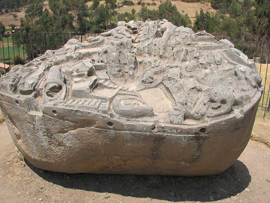
For the people of the Southern Hemisphere, the Crux constellation has a great deal of cultural significance. The Incas knew the constellation as Chakana (Quechua for "the stair"), and a stone image of the stars was found in Machu Picchu, Peru. To the Maori, the constellation was known as Te Punga, or "the anchor", due to the important role it played in maritime navigation.

The "Emu in the Sky", an important constellation recognized by the Aborigines of Australia. Credit: RSAA/ANU

To the Aborigines of Australia, the cross and the Coalsack Nebula together represented the head of the Emu in the Sky. This mythical bird is associated with several Aborigine creation myths and is one of the most important constellations in their astronomical traditions. Because of this significance, the Southern Cross is represented on the flags of Australia, Papua New Guinea, New Zealand Brazil, and Brazil.

The first recorded instance of Crux being named is believed to have occurred in 1455, when Venetian navigator Alvise Cadamosto made note of an asterism in the southern skies that he called carr dell'ostro ("southern chariot"). However, historians generally credit Portugese astronomer Joao Faras with the discovery, which occurred in 1500 when he spotted it from Brazil and named it "Las Guardas" ("the guards").

By the late 16th century, Crux began to be depicted as a separate constellation on celestial globes and maps. In these and subsequent maps, the name Crux was used (Latin for "Cross"), referring to the constellation's distinct shape.

History of Observation:

Crux was originally considered to be part of Centaurus, but as the precession of the equinoxes gradually lowered these stars below the European horizon, they were lost sight of, and so was the memory of these stars. At one time, around 1000 BCE, the stars of Crux were visible to the northern hemisphere, but by 400 CE they had slipped below the horizon for most populated areas.

The constellation Crux as it can be seen by the naked eye. Credit: Till Credner/AlltheSky.com

Even though it was originally plotted on Ptolemy's Almagest, it first appeared as "Crux" on the charts of Petrus Plancius and Jodocus Hondius in 1598 and 1600 - both navigators. It is known that Amerigo Vespucci mapped the stars of Crux on his expedition to South America in 1501, and with good reason!

Two of the stars of Crux (Alpha and Gamma, Acrux and Gacrux respectively) are commonly used to mark due south. Following the line defined by the two stars for approximately 4.5 times the distance between them leads to a point close to the Southern Celestial Pole. A definite point needed for navigation! In 1920, Crux was included among the 88 modern constellations recognized by the IAU.

Notable Objects:

Of the major stars in Crux, Alpha Crucis (Acrux) is the brightest, and the 12th brightest star in the night sky. It is located approximately 320 light years away and is a multiple star system composed of Alpha-1 Crucis (a B class subgiant) and Alpha-2 Crucis (a B class dwarf). Both stars are very hot and their respective luminosities are 25,000 and 16,000 times that of the Sun.

Beta Crucis (Becrux, or Mimosa) is the second brightest star of the Southern Cross and the 20th brightest star in the night sky. It is approximately 350 light years distant, is classified as a Beta Cephei variable, and is a spectroscopic binary composed of two stars that are about 8 AU apart and orbit each other every five years. The name Mimosa refers to its color (blue-hued).

Gamma Crucis (Gacrux) is a red giant that is approximately 88 light years distant from Earth. It is the third brightest star in the Crux constellation and the 26th brightest star in the sky. Located about 400 light years distant from Earth, this binary star is composed of a M4 red dwarf star and a A3 white dwarf star.

Crux is also associated with several Deep Sky Objects, the most notable of which is the Coalsack Nebula. This object is easily seen as a dark patch in the southern region of the Milky Way (hence the name) and crosses into the neighboring constellations of Centaurus and Musca. It is located about 600 light years from Earth and is between 30 and 35 light years in radius. In Aboriginal astronomy, the nebula represents the head of the Emu.

Then there's the Kappa Crucis Cluster (aka. the "Jewel Box" or "Herschel's Jewel Box"), an open star cluster that is located approximately 6,440 light years from Earth. It contains roughly 100 stars and is one of the youngest clusters ever discovered (only 14 million years old). To the naked eye, the cluster appears like a star near Beta Crucis.

Finding Crux:

The constellation itself consists of four bright, main stars and 19 stars which have Bayer/Flamsteed designations. It is bordered by the constellations of Centaurus and Musca. At present, Crux is visible at latitudes between +20° and -90°. While it is fairly circumpolar for the southern hemisphere, it is best seen a culmination during the month of May.

The location of the Crux constellation. Credit: IAU

Now, let's take out binoculars and examine its stars, started with Alpha Crucis, the "a" shape on our map. Its proper name is Acrux and it is the twelfth brightest star in the night sky. If you switch your binoculars out for a telescope, you'll find that 321 light year distant Acrux is also a binary star, with components separated by about 4 arc seconds and around one half stellar magnitude difference in brightness.

The brighter of the two, A1 is itself a spectroscopic binary star - with a companion that orbits no further away than our own Earth, yet is around 14 times larger than our own Sun! Needless to say, there's a very good chance this star may one day go supernova. While you're there, take a look an addition 90 arc seconds away for a third star. While it may just be an optical companion to the Acrux system, it does share the same proper motion!

Back to binoculars an on to Beta Crucis - the "B" shape on the map. Mimosa is located about 353 light years away from our solar system and it is also a spectroscopic binary star. This magnificent blue/white giant star is tied at number 19 as one of the brightest stars in the sky, and if we could put it side by side with our Sun it would be 3000 times brighter. Mimosa is also a multiply-periodic Beta-Cephi type star, too, fluxing by about 1/10 of a magnitude in as little as hours. What's going on? Inside Beta Crucis the iron content is only about half that of Sol and it's nearing the end of its hydrogen-fusing stage. When the iron core develops? Watch out! It's supernova time....

Now hang on to your binoculars and head north for Gamma Crucis, the "Y" shape on the map. Gacrux, is a red giant star approximately 88 light-years away from Earth. Did you notice its optical companion about 2 arc minutes away at an angle of 128 degrees from the main star? While the two look close together in the sky, the secondary star is actually 400 light years away! Gacrux shows its beautiful orange coloring to prove it has evolved off of the main sequence to become a red giant star, and it may even be evolving past the helium-burning stage.

The Coalsack Nebula and Kappa Crucis Cluster. Credit: A. Fujii

Move on now to Delta Crucis - the figure "8" on our map. Decrux is a red giant star located about 360 light years away from our vantage point. Delta Crucis is also Beta Cephei variable and changes its brightness just a tiny bit over a period of about an hour and 20 minutes. Another cool factoid about Delta Crucis is that it's a fast rotator - spinning at a speed of at least 194 kilometers per second at the equator and making a full rotation in about 32 hours.

This massive star also produces a massive stellar wind, shooting off 1000 times more material than our own Sun every second of every day! Or try R Crucis... It's also a Beta-Cephi type variable star, but it changes by nearly a full stellar magnitude in just a little over five days!

Keep your binoculars handy and head back to Beta and sweep south a degree and a half for the Kappa Crucis star cluster. This beautiful galactic cluster of stars commonly known as the Jewel Box (NGC 4755). After you see its glittering collection of multi-colored stars, you'll understand how it got its name! It is one of the youngest clusters, perhaps only a few million years old.

Kappa Crucis is also right on the edge of a dark void in the sky called the "Coal Sack". While you're looking around, you'll notice that there seem to be very few stars in this area. That's because they are being blocked by a dark nebula! The Coal Sack is a large, dark dust cloud about 500 light years away and it's blocking out the light from stars which lie beyond it. The few stars you do see are in front of the cloud and much nearer to the Earth.

The Jewel Box - the Kappa Crucis Cluster. Credit: ESO/NASA/ESA/Digitized Sky Survey 2/Jesús Maíz Apellániz (Instituto de Astrofísica de Andalucía, Spain)

Now it's telescope time. Head to Alpha Crucis and slightly less than 2 degrees east for NGC4609. Also on the edge of the Coalsack, this large, fairly condensed open cluster contains about 40 members and they are well spread across the sky. The pattern somewhat resembles the constellation of Orion (in the imagination, of course!). Mark you observing notes for Caldwell 98. Next stop? Back to Delta and less than 3 degrees south/southwest for NGC4103, another open cluster on the edge of night. With a little bit of imagination, this grouping of stars could appear to look like a celestial water tower!

We have written many interesting articles about the constellation here at Universe Today. Here is What Are The Constellations?, What Is The Zodiac?, and Zodiac Signs And Their Dates.

Be sure to check out The Messier Catalog while you're at it!

For more information, check out the IAUs list of Constellations, and the Students for the Exploration and Development of Space page on Canes Venatici and Constellation Families.

Sources:

By Tammy Plotner
Tammy was a professional astronomy author, President Emeritus of Warren Rupp Observatory and retired Astronomical League Executive Secretary. She's received a vast number of astronomy achievement and observing awards, including the Great Lakes Astronomy Achievement Award, RG Wright Service Award and the first woman astronomer to achieve Comet Hunter's Gold Status. (Tammy passed away in early 2015... she will be missed)

88 IAU constellations, Acrux, Almagest, Constellations, Crux, Featured, Mimosa, the southern cross

miércoles, 30 de agosto de 2017

MacEwan University professor plans to explore doomed Incan site before city engulfs it

It's not uncommon for developments to pop up over places of historic significance.

But for MacEwan University anthropology professor Lidio Valdez Cardenas, the expansion of a small Peruvian city is hitting close to home.

Acari, located in southern Peru, continues to grow, but is surrounded by desert on all sides, meaning that an old excavation site, formerly part of the Incan Empire, is one of the few remaining places it can develop.

According to Cardenas, who was born in Peru, the site will soon be no more.

Cardenas cut his teeth as an archeologist at the site, having been shown the ropes by esteemed California-based archeologist Francis Riddell, who died in 2002.

"He was like a father to me, and his dream was to work outside and if possible die there," he said. "It's some kind of tribute to him."

Cardenas spent the summer on a grant from the Social Sciences and Humanities Research Council mapping out the site in anticipation for next summer, when he will bring four MacEwan students and four Peruvian students to the town in the hopes of gleaning new information about the old ruins.

The site was the Incan administrative centre of the area.

All artifacts found on the site are property of the Peruvian government, he said.

Overall, Canada lacks a healthy interest in the history of what is now Latin America, Cardenas said, adding that there are few academics in the country who look into it.

"In Canada especially, we don't have many archeologists writing about the Inca. I think it's an important issue," he said.

Pre-Incan imbibing

On a lighter note, Cardenas is also something of an expert on the historic beers of Peru.

In 2001, at a different excavation site, Cardenas found a large stone slab that he assumed was the entrance to a burial site.

Contrary to any macabre expectations, as he and his colleagues dug beneath the stone, they found dozens more just like it, along with crescent-shaped rocks - used to crush maize, beans, berries, etc. - and large ceramic jugs used to boil, cool and ferment a kind of local beer called chicha.

"The fact that we came across the stones on a larger scale, and so many vessels, makes me believe that this was more likely a place that, long before the Incas, people have been producing beer on a large scale," he said.

Cardenas found that there was an abundance of research in North America about the more common corn-based chicha recipes, but almost nothing on the brews made from the berries of the molle tree, which he grew up making, though hasn't in many years.

Additionally, he found that the practice of making chicha, of all kinds, has fallen out of favour in Peru, having been replaced by mass-produced commercial brews, though the recipes still live on among many of the locals.

"About 10 years ago, 15 years ago, you could still find the beer everywhere," he said, adding this is becoming increasingly rare.

Bizarre 'alien' tomb found by Brit investigators in Peru

UFO investigators claim that the discovery of mummified 'aliens' in a tomb in Peru are linked to the Roswell UFO conspiracy.

British UFO boffins travelled to Cusco in Peru to look into five 1,700 year-old mummies that conspiracy theorists claim look more reptilian than human.

New images of the "alien mummies" were unveiled during a press conference called "The mummies of Nazca" in Peru by Mexican ufologist and journalist Jamie Maussan last month.

Investigadores de OVNI afirman que el descubrimiento de "alienígenas" momificados en una tumba en Perú están vinculados a la conspiración OVNI de Roswell.

Británicos UFO boffins viajó a Cusco en Perú para mirar en cinco mil 1.700 momias de edad que los teóricos de la conspiración dicen mirar más reptilian que humanos.

Nuevas imágenes de las "momias alienígenas" fueron reveladas durante una conferencia de prensa titulada "Las momias de Nazca" en Perú por el ufólogo y periodista mexicano Jamie Maussan el mes pasado.

UFO investigators claim that the discovery of mummified 'aliens' in a tomb in Peru are linked to the Roswell UFO conspiracy.

British UFO boffins travelled to Cusco in Peru to look into five 1,700 year-old mummies that conspiracy theorists claim look more reptilian than human.

Steve Mera claims he was told a foldable 'alien' metal was found in Peru

Major Jesse Marcel from the Roswell Army Air Field with debris found 75 miles north west of Roswell in June 1947

But while they were out there they were told that a "self-folding foil-like metal" was also found in the tomb.

The metal could be the same self-repairing material that UFOlogists claim was found near the crash site in Roswell, in the US state of New Mexico.

He said: "Some of these things are getting out there, and one of these things was apparently just like the Roswell... incident.

"This foil that unfolds itself - some of this was found and sold for only $8,000 to someone in Asia.

He added: "The (Peruvian) government is struggling to contain this problem of tomb raiders... who are getting hold of these artefacts and are being sold across the world on some sort of black market."

New images of the "alien mummies" were unveiled during a press conference called "The mummies of Nazca" in Peru by Mexican ufologist and journalist Jamie Maussan last month.

In the summer of 1947, a farmer discovered unidentifiable debris in his sheep fields just outside Roswell, New Mexico.

The debate rumbles on, with people continuing to make claims about “leaked US government documents”, which supposedly prove it was a cover-up.

X-rays of the so-called mummified remains were shown during a press conference to attempt to banish claims that they were fake

Could there be a link between mummified remains in Peru and the Roswell incident?

This included X-rays of the mummified remains so Maussan could banish claims that they were fake or made of plaster, Ruptly has reported.

Mr Maussan alleges that of the five bodies discovered, three of them had "characteristics that are closer to reptiles than humans".

He added: "Nobody has proved it is a fraud.

"We are going to present preliminary evidence that will determine in the vision of the media, in the collective vision of the popular conscious, the validity that it has."

Maussan has claimed carbon dating samples of the body dates between 245 to 410 AD, though the result has not been verified as true.

Footage of the so-called mummified alien was released in June though some were not convinced.

Supposedly filmed in the ancient city of Nazca, Peru, users pointed out the “corpse” looks like it is a half-finished cardboard creation.

While some have said they will keep an 'open mind' about the 'alien mummies' others have branded them as fake

The video was posted by website Gaia.com which charges curious users money to view their exclusive paranormal content.

The site claims the extraterrestrial beast’s body was dug up during an excavation of the mysterious caves.

One viewer reported commented: "Something seems off. The corpse looks like it was made of plaster.”

Earlier in July we reported how the "discovery" prompted a number of experts and conspiracy theorists to offer their opinion.

In a short documentary on the bizarre find, Dr Konstantin Korotkov, who claims to be a professor at Saint-Petersburg University, claims these features are not a deformity – it is “another creature, another humanoid”.

One website, Ancient Origins says: “We should keep an open mind.”

Maussan has claimed carbon dating samples of the body dates between 245 to 410 AD, though the result has not been verified as true

Some point to the fact people are being charged up to $300 (£232) to attend a conference to discuss it as proof it is fake.

Nigel Watson, author of the UFO Investigations Manual, told MailOnline: “This seems to be a plaster cast over a bone structure with three fingers attached to the hands.

“Such hoaxes are the product of wishful thinking mixed with greed and a lust for publicity.”

Investigadores de OVNI afirman que el descubrimiento de "alienígenas" momificados en una tumba en Perú están vinculados a la conspiración OVNI de Roswell. Británicos UFO boffins viajó a Cusco en Perú para examinar cinco momias de 1.700 años de edad que los teóricos de la conspiración dicen buscar más reptilian que humanos. Steve Mera afirma que le dijeron que se encontró un metal "alien" plegable en Perú El mayor Jesse Marcel del Campo Aéreo del Ejército de Roswell con escombros halló 75 millas al noroeste de Roswell en junio de 1947 Pero mientras estaban allí, se les dijo que en la tumba también se encontraba un "metal parecido a una lámina". El metal podría ser el mismo material auto-reparador que los ufólogos afirman haber sido encontrado cerca del sitio del accidente en Roswell, en el estado de Nuevo México. Dijo: "Algunas de estas cosas están saliendo por ahí, y una de estas cosas fue aparentemente como el incidente de Roswell ...". "Este papel de aluminio que se despliega - algo de esto fue encontrado y vendido por sólo $ 8,000 a alguien en Asia. Agregó: "El gobierno (peruano) está luchando para contener este problema de los invasores de tumbas ... que se están apoderando de estos artefactos y se están vendiendo en todo el mundo en algún tipo de mercado negro". Nuevas imágenes de las "momias alienígenas" fueron reveladas durante una conferencia de prensa titulada "Las momias de Nazca" en Perú por el ufólogo y periodista mexicano Jamie Maussan el mes pasado. En el verano de 1947, un agricultor descubrió restos no identificables en sus campos de ovejas en las afueras de Roswell, Nuevo México. El debate retumba, y la gente continúa haciendo afirmaciones sobre "documentos filtrados del gobierno de Estados Unidos", lo que supuestamente demuestra que fue un encubrimiento. Las radiografías de los así llamados restos momificados se mostraron durante una conferencia de prensa para intentar desterrar las afirmaciones de que eran falsas ¿Podría haber un vínculo entre restos momificados en el Perú y el incidente de Roswell? Esto incluyó rayos X de los restos momificados para que Maussan pudiera desterrar las afirmaciones de que eran falsos o hechos de yeso, informó Ruptly. El Sr. Maussan alega que de los cinco cuerpos descubiertos, tres de ellos tenían "características más cercanas a los reptiles que los humanos". Él agregó: "Nadie ha demostrado que es un fraude. "Vamos a presentar evidencia preliminar que determinará en la visión de los medios de comunicación, en la visión colectiva de la conciencia popular, la validez que tiene". Maussan ha reclamado muestras de datación de carbono de las fechas de cuerpo entre 245 a 410 dC, aunque el resultado no se ha verificado como cierto. Se grabaron videos de los llamados alienígenas momificados en junio, aunque algunos no estaban convencidos. Supuestamente filmado en la antigua ciudad de Nazca, Perú, los usuarios señalaron el "cadáver" parece que es una creación de cartón a medio terminar. Mientras que algunos han dicho que mantendrán una "mente abierta" sobre las "momias extranjeras" otros los han calificado como falsos El video fue publicado por el sitio web Gaia.com, que cobra a los usuarios curiosos dinero para ver su contenido paranormal exclusivo. El sitio afirma que el cuerpo de la bestia extraterrestre fue desenterrado durante una excavación de las misteriosas cuevas. Un espectador comentó: "Algo parece apagado, el cadáver parece estar hecho de yeso". A principios de julio informamos de cómo el "descubrimiento" hizo que varios expertos y teóricos de la conspiración ofrecieran su opinión. En un breve documental sobre el hallazgo extraño, el Dr. Konstantin Korotkov, que afirma ser un profesor en la Universidad de San Petersburgo, afirma que estas características no son una deformidad - es "otra criatura, otro humanoide". Un sitio web, Ancient Origins dice: "Debemos mantener una mente abierta". Maussan ha reclamado muestras de datación de carbono de las fechas de cuerpo entre 245 a 410 dC, aunque el resultado no se ha verificado como cierto Algunos apuntan a que la gente se está cobrando hasta $ 300 (£ 232) para asistir a una conferencia para discutirlo como prueba de que es falso. Nigel Watson, autor del Manual de Investigaciones de OVNI, le dijo a MailOnline: "Esto parece ser un yeso sobre una estructura ósea con tres dedos pegados a las manos. "Estos engaños son el producto de un deseo ilusorio mezclado con la avaricia y una lujuria por la publicidad".

jueves, 24 de agosto de 2017

The first tablet was created much earlier than expected


A 3,700-year-old Babylonian clay tablet discovered by the real Indiana Jones has been revealed as the world’s oldest — and most accurate — trigonometric table.

Mathematicians believe that the tablet, known as Plimpton 322, may have been used by ancient mathematical scribes to calculate how to build palaces, temples and build canals.

The new research shows the Babylonians beat the Greeks to the invention of trigonometry — the study of triangles — by more than 1,000 years.

The tablet was discovered in the early 1900s in what is now southern Iraq by archaeologist, diplomat and antiquities dealer Edgar Banks, the person on whom the fictional character Indiana Jones was based.

It has four columns and 15 rows of numbers written on it in the cuneiform script of the time using a base 60, or sexagesimal, system.

UNSW / Andrew Kelly / SWNS.com

Dr. Daniel Mansfield, of the University of New South Wales (UNSW) in Australia, said: “Plimpton 322 has puzzled mathematicians for more than 70 years, since it was realized it contains a special pattern of numbers called Pythagorean triples.

“The huge mystery, until now, was its purpose — why the ancient scribes carried out the complex task of generating and sorting the numbers on the tablet.

“Our research reveals that Plimpton 322 describes the shapes of right-angle triangles using a novel kind of trigonometry based on ratios, not angles and circles. It is a fascinating mathematical work that demonstrates undoubted genius.”

He added: “The tablet not only contains the world’s oldest trigonometric table; it is also the only completely accurate trigonometric table, because of the very different Babylonian approach to arithmetic and geometry.

“This means it has great relevance for our modern world. Babylonian mathematics may have been out of fashion for more than 3000 years, but it has possible practical applications in surveying, computer graphics and education.

“This is a rare example of the ancient world teaching us something new.”

The new study, by Mansfield and his UNSW colleague Associate Professor Norman Wildberger was published in the journal Historia Mathematica.

A trigonometric table allows people to use one known ratio of the sides of a right-angle triangle to determine the other two unknown ratios.

The Greek astronomer Hipparchus has long been regarded as the father of trigonometry, with his “table of chords” on a circle considered the oldest trigonometric table.

But Dr Wildberger said: “Plimpton 322 predates Hipparchus by more than 1,000 years.

“It opens up new possibilities not just for modern mathematics research, but also for mathematics education.”

He added: “With Plimpton 322 we see a simpler, more accurate trigonometry that has clear advantages over our own.

UNSW / Andrew Kelly / SWNS.com

“A treasure-trove of Babylonian tablets exists, but only a fraction of them have been studied yet.

“The mathematical world is only waking up to the fact that this ancient but very sophisticated mathematical culture has much to teach us.”

He said the 15 rows on the tablet describe a sequence of 15 right-angle triangles, which are steadily decreasing in inclination.

The left-hand edge of the tablet is broken and the UNSW researchers built on previous research to present new mathematical evidence that there were originally six columns and that the tablet was meant to be completed with 38 rows.

They also showed how the ancient scribes, who used a base 60 numerical arithmetic similar to our time clock, rather than the base 10 number system we use today, could have generated the numbers on the tablet using their mathematical techniques.

The researchers also provided evidence that discounts the widely-accepted view that the tablet was simply a teacher’s aid for checking students’ solutions of quadratic problems.

Mansfield added: “Plimpton 322 was a powerful tool that could have been used for surveying fields or making architectural calculations to build palaces, temples or step pyramids.”

The tablet, which is thought to have come from the ancient Sumerian city of Larsa, has been dated to between 1822BC and 1762BC. It is now in the Rare Book and Manuscript Library at Columbia University in New York.